 Many educators are seeking for learning material to include hands-on learning about basic scientific methods and approaches into school learning in the hope to develop their interest and skills in scientific inquiry. Often, existing material is closely linked to specific subject areas and it is challenging for educators to strip off and replace content while maintaining its essence.
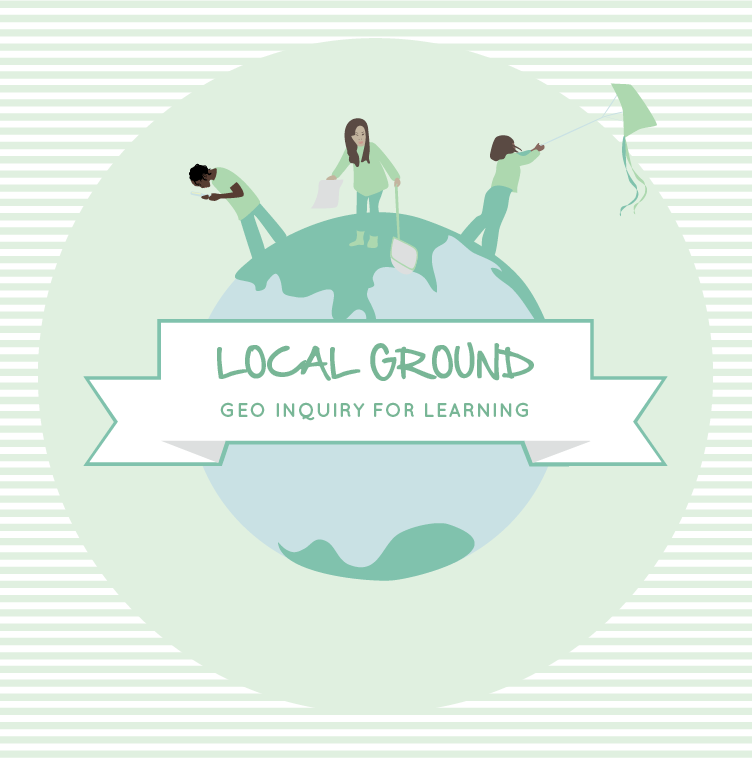
Local Ground Geo Inquiry is a process for youths to ask questions about place, to investigate these questions using hands-on data-collection tools and methods, and to use collected evidence to create reports, presentations and design suggestions. Seven subject non-specific learning activities are included, facilitating educators to adopt the geo inquiry process to their subject area. The learning activities specifically focus on how to use Local Ground, an open source and web-based participatory mapping tool for youth, to plan and perform a data-driven scientific enquiry process that relates to personally meaningful challenges and opportunities in their school community.
Through the process, students may become storytellers and poets of data telling stories of what investigated patterns tell us about the world and how these patterns inform how we could make a difference. The slowness facilitated through Local Ground is aimed to cultivate critical thinking skills and the ability to reflect, to support the gathering of evidence that could strengthen or weaken claims, and to prepare students for situations that require them to defend their ideas.
The most important part of inquiry process is formulating researchable questions that are interesting to the person asking the question. Research questions can be generated by anyone: educators, students, school community partners, or collaboratively among a group. For best results, ensure that your questions are interesting to students, and are answerable using empirical evidence, that is evidence that you can observe, measure and access.
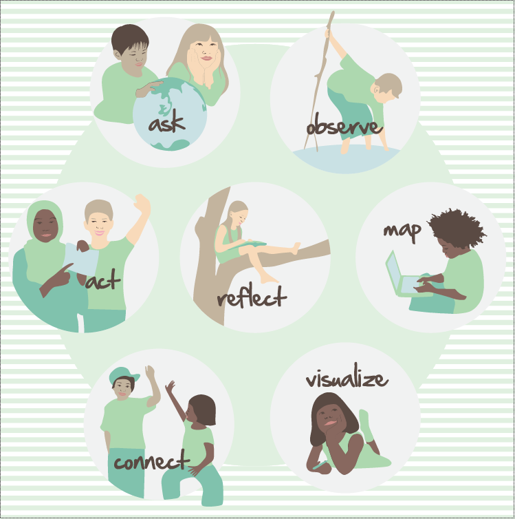
Local Ground Geo Inquiry consists of seven modular, subject non-specific learning activities that can be combined to facilitate an iterative and context specific geo inquiry process. Individual learning activities can be performed more than once during the learning process. While we recommend to facilitate all seven activities and iterations of them, it is also possible to perform individual activities only. The activities are:
ASK – Generate research questions and plan a geo inquiry
OBSERVE – Collect and acquire geo-data
MAP – Georeference, transcribe and prepare data for analysis
VISUALIZE – Explore trends, relationships and patterns
CONNECT – Try to explain causes for observed patterns
ACT – Go out and make a difference
REFLECT – Think about what you did, what you can do and how it will
During the iterative Local Ground Geo Inquiry process students generate research questions and plan an inquiry, collect and acquire geo data, geo reference, transcribe and prepare data for analysis, explore trends, relationships and patterns, explain what the patterns tell about the world, and identify how they could make a difference. Reflection about what they did and what they plan to do next is an intrinsic part of the iterations of the Local Ground Geo Inquiry process. Educators are encouraged to mix, match and adopt the Geo Inquiry activities to best suit their classroom context.
Each activity includes a brief overview, ideas for using Local Ground, what educators can look forward to when performing the activity and suggestions of what students may learn. To support students in planning and performing a Local Ground Geo Inquiry, Local Ground Geo Inquiry challenges educators to expand their role in the learning of their students. Each activity includes descriptions of how to (1) prepare and shape learning activities by carefully listening to students’ interests and needs; (2) inspire the students by evoking a shared experiences and the feeling of being part of a meaningful endeavour; (3) coach the students by offering practical, hands-on advice, guidance and support, connecting students to people outside of school, challenging assumptions through open ended questions, (4) assess students’ achievements based on collaboratively designed criteria.
The learning activities were created in collaboration with Dr. Tapan Parikh and doctoral student Sarah Van Wart of the Represent research Group.
Local Ground Geo Inquiry,This post is also available in: Turkish


I had an opportunity to go over this laerning activity while translating it into Turkish .I think the best aspect of this learning activity is its having non specific learning activity structure and its adoptibility to differents subject areas easily which will encourage most of the teachers to work on with their students using different learning modalities.
Thank you 🙂
Adil